Hiking Near Solvang & the Santa Ynez Valley
The Santa Ynez Valley sits at the edge of Los Padres National Forest, between the Santa Ynez Mountains and the San Rafael Mountains — and within 30 minutes of some of the best hiking in Central California. From an easy waterfall walk to a serious summit push, options exist for every ability level.
Quick Trail Finder
The Trails
Nojoqui Falls Trail
Nojoqui Falls County Park
Distance
1 mile round trip
Drive from Solvang
8 miles south of Solvang
Elevation
Minimal gain
Best season
Best Nov–May (waterfall flows)
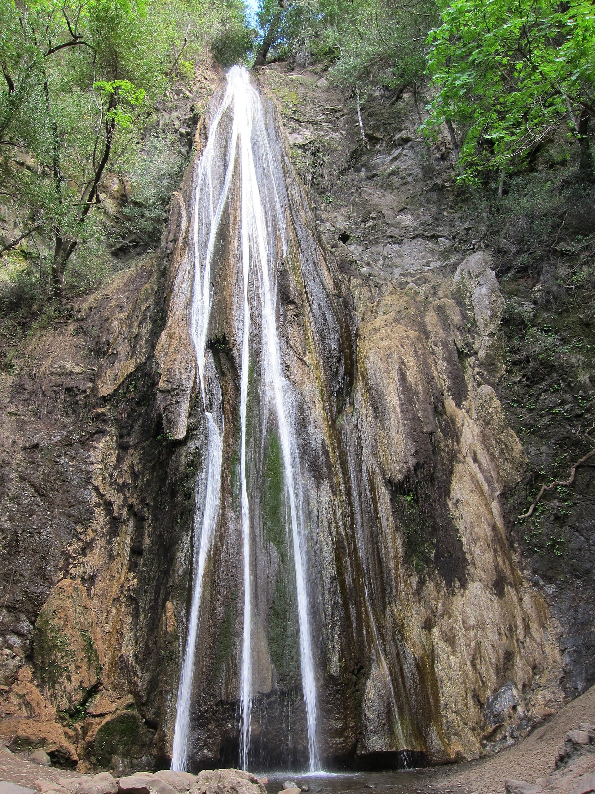
The closest and most accessible trail from Solvang. A shaded creek-side path leads to a 164-foot limestone waterfall hidden in a canyon. The trail is almost entirely flat and suitable for all ages and fitness levels. The falls run strongest after rain (November through May); in summer the flow can be minimal. The park has picnic tables, restrooms, and no entrance fee. Getting there: from Solvang, head south on Alisal Road to Alisal Ranch Road, then follow signs to the park. Easy to combine with the drive back to US-101.
Dogs allowed on leash
Figueroa Mountain Loop
Los Padres National Forest
Distance
4–8 miles (varies by route)
Drive from Solvang
25 miles north of Los Olivos
Elevation
800–1,200 ft gain depending on trailhead
Best season
Mar–May for wildflowers; year-round otherwise
The crown jewel of Santa Ynez Valley hiking. Figueroa Mountain Road (a paved but winding drive) climbs from Los Olivos to near the 4,528-foot summit area, where multiple trailheads fan out across the mountain. The Ranger Peak Trail and Catway OHV Road offer the best loop options. In March and April, the wildflower display — goldfields, lupine, poppies, clover — is among the best in Southern California and draws significant crowds on peak bloom weekends. The summit views on clear days reach the Pacific Ocean to the south and the Sierra Nevada to the east. Adventure Pass ($5/day or $30/year) required for parking in Los Padres National Forest.
Dogs allowed on leash
Gaviota Peak Trail
Gaviota State Park
Distance
6.1 miles round trip
Drive from Solvang
25 miles southwest of Solvang
Elevation
2,458 ft gain
Best season
Year-round; cooler than inland in summer
A steady uphill hike to a peak with sweeping views of the Santa Barbara Channel, the Channel Islands, and the Pacific Coast. The trail starts from the Gaviota State Park hot springs trailhead and climbs through chaparral and oak woodland. The summit is a legitimate effort but not technically difficult — just relentlessly uphill. The payoff view is excellent. Day use fee applies at Gaviota State Park. There is also a Hot Springs Canyon trail in the park that leads to natural warm springs — a shorter, easier alternative.
Dogs allowed on leash
Cachuma Lake Nature Trail
Lake Cachuma Recreation Area
Distance
1–3 miles (multiple short loops)
Drive from Solvang
15 miles east of Solvang on Hwy 154
Elevation
Minimal
Best season
Year-round; bald eagle watching Dec–Feb
Lake Cachuma is a Santa Barbara County reservoir 15 miles east of Solvang on scenic Highway 154. The recreation area has several short nature trails ideal for birding and casual walks. The lake is one of the best spots in Southern California to see bald eagles in winter (December through February) — the county runs ranger-led eagle boat cruises on winter weekends. The area also has camping, boat rentals, and picnic facilities. A good option for families who want some nature exposure without a serious hike.
Dogs allowed in campground areas
Happy Canyon Road Trail
Santa Ynez Valley
Distance
Variable (dirt road walking)
Drive from Solvang
10 miles east of Solvang
Elevation
Varies by route chosen
Best season
Spring and fall ideal; hot in summer
Happy Canyon Road runs northeast from Santa Ynez into the hills, transitioning from a paved ranch road to dirt. The road and adjacent trails pass through oak woodland, grassland, and chaparral typical of the interior Santa Ynez Valley. It's less managed than a state park trail and requires more navigation, but rewards solitude and genuine Central Coast wilderness. Best for experienced hikers comfortable with unmarked routes. Check fire conditions before visiting — this area can close during high fire danger.
Generally permitted
La Purísima Mission Trail System
La Purísima Mission State Historic Park, Lompoc
Distance
8 miles of trail total
Drive from Solvang
25 miles west of Solvang
Elevation
Minimal
Best season
Year-round
La Purísima Mission State Historic Park near Lompoc combines California history with outdoor space. The 2,000-acre park has 8 miles of multi-use trails through coastal scrub and grassland surrounding the most completely restored California mission. The trails loop around the mission grounds and out into the surrounding hills. A good choice if you want to combine a history stop with easy walking. Day use fee. Combine with a visit to Lompoc's flower fields if visiting in spring.
Dogs allowed on leash on trails
Seasonal Hiking Conditions
Before You Go
- Water: Bring more than you think you need. The interior valley is dry; no reliable water sources on most trails.
- Fire conditions: Some trails in Los Padres National Forest close during Red Flag conditions or active fires. Check with the Santa Barbara Ranger District before heading out in fall.
- Adventure Pass: Required for parking at most Los Padres National Forest trailheads — $5/day or $30/year, available online or at ranger stations.
- Cell coverage: Limited on Figueroa Mountain Road and back-country trails. Download maps offline before leaving the valley.
- Ticks: Present in chaparral and oak woodland year-round. Check after hiking through brush.
- Mountain lions: Present in the Santa Ynez Mountains and surrounding ranges. Rare encounters, but know standard protocols — make noise, don't run, make yourself large.